Further Afield:
Franklin Parker Preserve, A Pine Barrens Route
The Pine Barrens of New Jersey is a striking country of other-worldly, sandy hillocks stabilized by pitch pine. This 10-mile ride for your e-bike weaves through restored wetlands of former cranberry bogs, then dips into the pine forests. Study the various landforms or just absorb the beauty.
![]()
Length: 10.2 miles
Elevation change: 87 feet
Nearby Towns: Chatsworth, Tabernacle
Begin and End: At the Franklin Parker Preserve Gate, 1450 County Rd 532, Chatsworth, NJ
Nearby Camping: Brendan T. Byrne State Forest
About two miles into the Green Trail in Franklin Parker Preserve, I began to feel like I’d ridden into secret summer.
It was mid-January. In my hometown of Tarrytown, two hours to the north, the temperature was ten degrees cooler. But here in the wide-open expanse of former cranberry bogs and blueberry fields, surrounded by the electric green of the pitch pines that this landscape is famous for, it felt like a late spring morning.
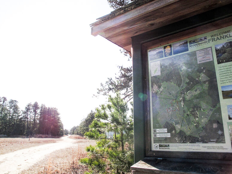
A trailhead kiosk near the start of the Green Trail at Franklin Parker Preserve.
Maybe it’s those occasional patches of soft white sand that can remind you of beach weather. But it’s also those pines, those deep green arms of needles that can make you forget the winter monotony of a gray deciduous forest. The younger, fluffier pines that line this route seem to shimmer in the sun. They create a striking umbrella over your head as you take these easy paths past the livid blue of the open water.
Franklin Parker Preserve is the perfect place to immerse yourself in the Pine Barrens ecosystem. Its 17-square-mile expanse provides a variety of terrains, from gorgeous wetlands to upland pine forests, with more than 21 miles of not-too-challenging trails to ride. And as ecological treasures go, the preserve is fortunate; it’s home to several species of endangered animals and rare plants. Keep your eye out for bald eagles and bobcats, lady slipper and yellow-fringed orchids, and other rare species of wetland plants.
I love this ride; whenever I get the feeling that winter will never end, I watch the weather, wait for a warmish spell, then happily drive the two hours it takes to get from my house north of the city to central Jersey.
The Ride
Leave your car in the spacious parking area at the Franklin Parker gate off Route 532. For the first part of this route, you’ll be following the Green Trail. It’s reliably marked, as are all the trails, with a post and a colored blaze.
All trails in the preserve are open to bikes EXCEPT the Red Trail. That one is for foot travel only, and although you’ll see the Red Trail disappear into a tantalizing thicket of blueberry, stay off Red! (You can always park and lock your bike to go on foot if you have the need to explore.)
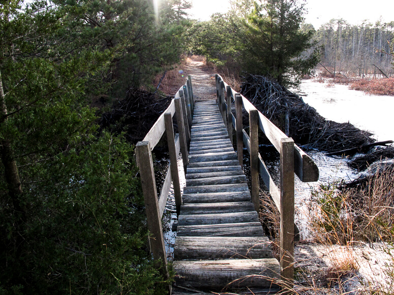
A bumpy crossing over a section of wetland enlarged by beaver activity.
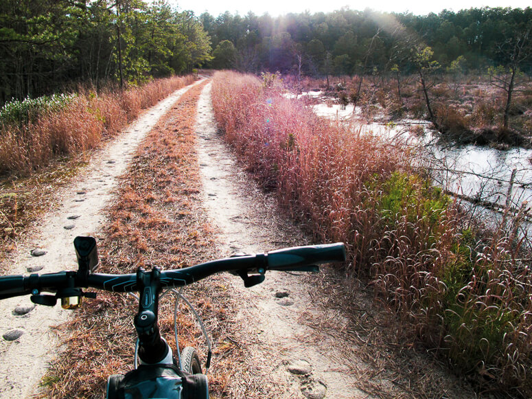
At first, the route weaves through a fascinating wetland, criss-crossing a series of overgrown dikes and canals. Once an active cranberry and blueberry farm, the ecosystem has recently been restored to a naturally-functioning wetland, but reminders of its past are here and there: cinder-block huts peek out from pines as you ride along the old roads.
The trails in this part of the preserve are generally wide double track, dry and sandy. Watch out for occasional patches of soft, white sand. This stuff can really muscle your tires around if they are not very wide (none of this ride is suited to a thin-tire road bike). The tires on my hybrid bike are not very wide, but they did just fine on these trails.
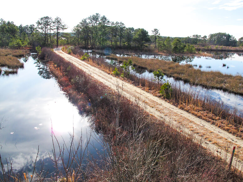
Eventually you leave the bogs behind and enter a wilder area of lakes and marsh. And that brings me to my first word of advice: wear mud boots. In mid-January, I encountered a few areas where the marsh has overflowed the trail. Not by much; at most I stepped through five inches or so of water. But that’s enough to give you cold wet feet for the rest of the ride. I wear rain boots that hit just below my knees for this ride, and packed some extra socks in my bag just in case!
I also recommend having a printed map as well as your RideWithGPS app. There are so many trails to explore, and plenty of ways to lengthen or shorten your time at Franklin Parker.
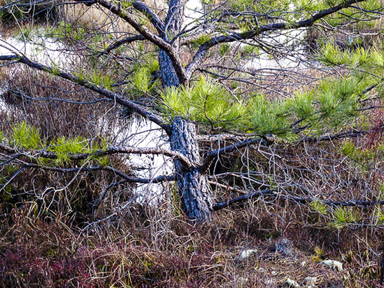
Pitch and white pine are ubiquitous in the barrens. They provide welcoming shades of green and red amid the tawny colors of winter.
The Details:
Elevation change: A mere 122 feet up and down over the whole ride. The Pine Barrens are famous for flatness.
Direction: For best results, leave your car in the Franklin Parker preserve parking area off Route 532. There is another entrance on Route 563, called the Speedwell entrance. There’s a parking area there, too (39°46’43.8″N 74°32’27.8″W). But the route described here starts at the main entrance in Chatsworth.
Follow the route as described in RideWithGPS, using the app and your smartphone.
The Roads and Trails:
- Lots of sand, but much of it — most of it — is hard-packed and fairly easy to ride on with hybrid bike tires. A thin-tire road bike would not fare well here.
- Some trails can be covered in water in short sections where they cross the marsh. I strongly recommend wearing waterproof knee boots or bringing along plastic bags to cover your shoes while walking through this water. (Another option: These.) You won’t encounter water deeper than five inches or so, but any time you get your shoes and socks soaked can make for an uncomfortable ride.
- There are certainly other combinations of rides you can make; this route was plotted taking into account that one trail in the cranberry bogs was completely impassable, as a bridge had washed out. I’ll update the route when the bridge is back up.
- There are no surfaced roads within the preserve.
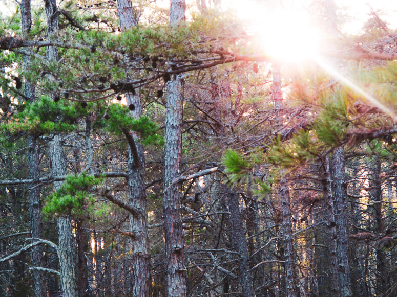
The pitch pine forests of the New Jersey pine barrens

Cranberry bog trail
Green Trail, Franklin Parker Preserve
Sandy trail through the cranberry bogs
More e-bike routes you might like:

An Old Croton Aqueduct E-Bike Route

The Steep Rock

The Garrison
