Waiting for the snow to melt is the hardest part of winter for me. When I’m desperate enough, I throw the bike in the car and head south, to the Pinelands of New Jersey.
![]()
Summary:
In winter, use a snow depth map, like the one at WeatherStreet.com, to find places to bike snow-free.
When there’s too much snow and ice on the roads, I leave biking for a little while and do other things. Clean my house. Think about biking.
But I keep an eye on the weather, because now and then a nice warm February break in all this cold can be just enough to clear all that snow away.
Most of the routes on this website are north of Westchester County, in New York — close to the city. And most of them involve some degree of unpaved road, or at least barely-used country roads that may be paved but are often unploughed.
I would love to try fat-tire electric biking, but for now my wheels aren’t a good fit for the snow and ice on backcountry roads.
So I look south.
In the fabled New Jersey Pinelands, it’s just slightly warmer — usually close to ten degrees warmer than southern Westchester — enough to clear the snow away more quickly. There might be ten inches of snow here, and clear ground in the pine barrens.
So I watch the snow depth maps, which I’ve found to be really accurate as far as predicting how much snow will meet me when I finish the 2 1/2 hour drive south.
Snow Depth Maps
My favorite snow depth map is at weatherstreet.com. It’s accurate, somewhat easy to use (there are lots of cluttery links), and so useful this time of year.
Just navigate to the site, and in the small box at the very top right (“Enter Zip Code or City State”), enter where you’d like to go, plus the word “snow”. Don’t forget to enter the word “snow”. Then, in the screen that appears, scroll to the bottom map (not the top one!) to see snow depths. These maps are updated every hour.
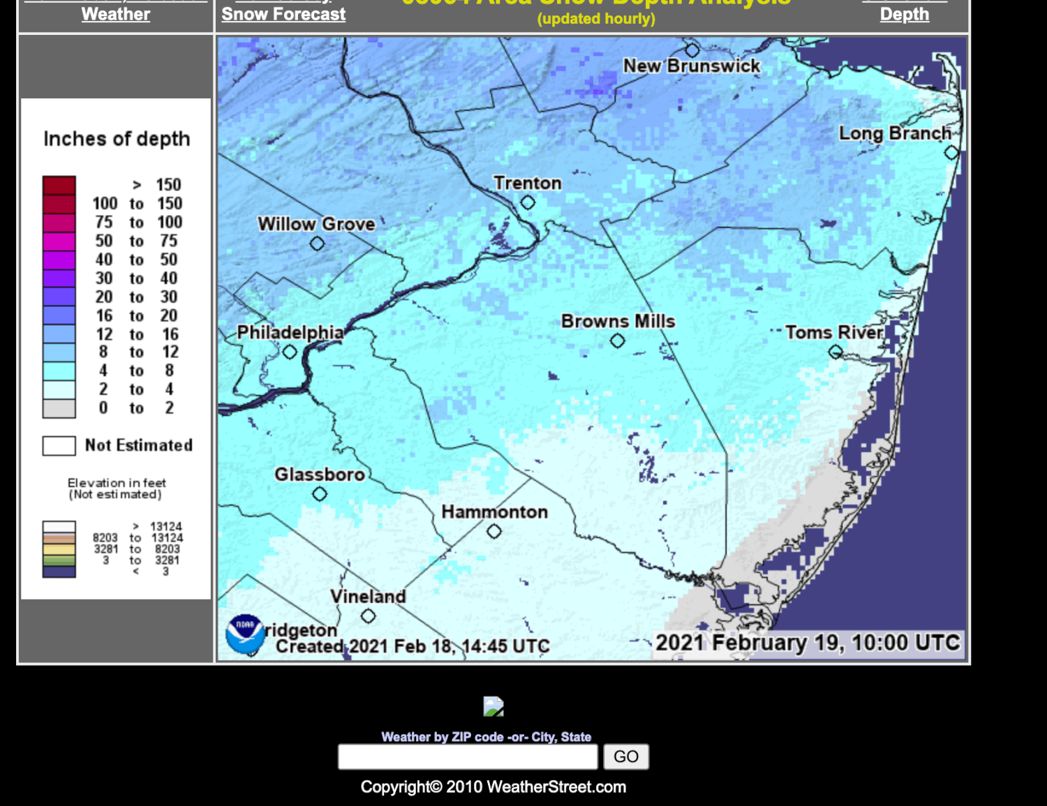
A snow depth map from weatherstreet.com showing southern New Jersey, after the Feb. 18th snowstorm. Green on the map (there’s none here yet) indicates no snow on the ground. To convert UTC time to Eastern Time Zone time, subtract five hours.
I’ve used the snow depth maps to plan when I head south. Since the maps are updated every hour, a lot can change in one day, so I keep watching, even before I leave for the day.
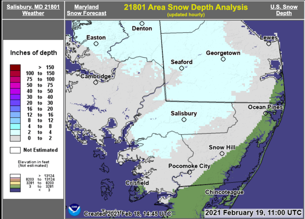
Snow depth map from Weatherstreet.com showing the area around Salisbury, Maryland. The green patches at the southeast indicate no snow cover.
The Pine Barrens
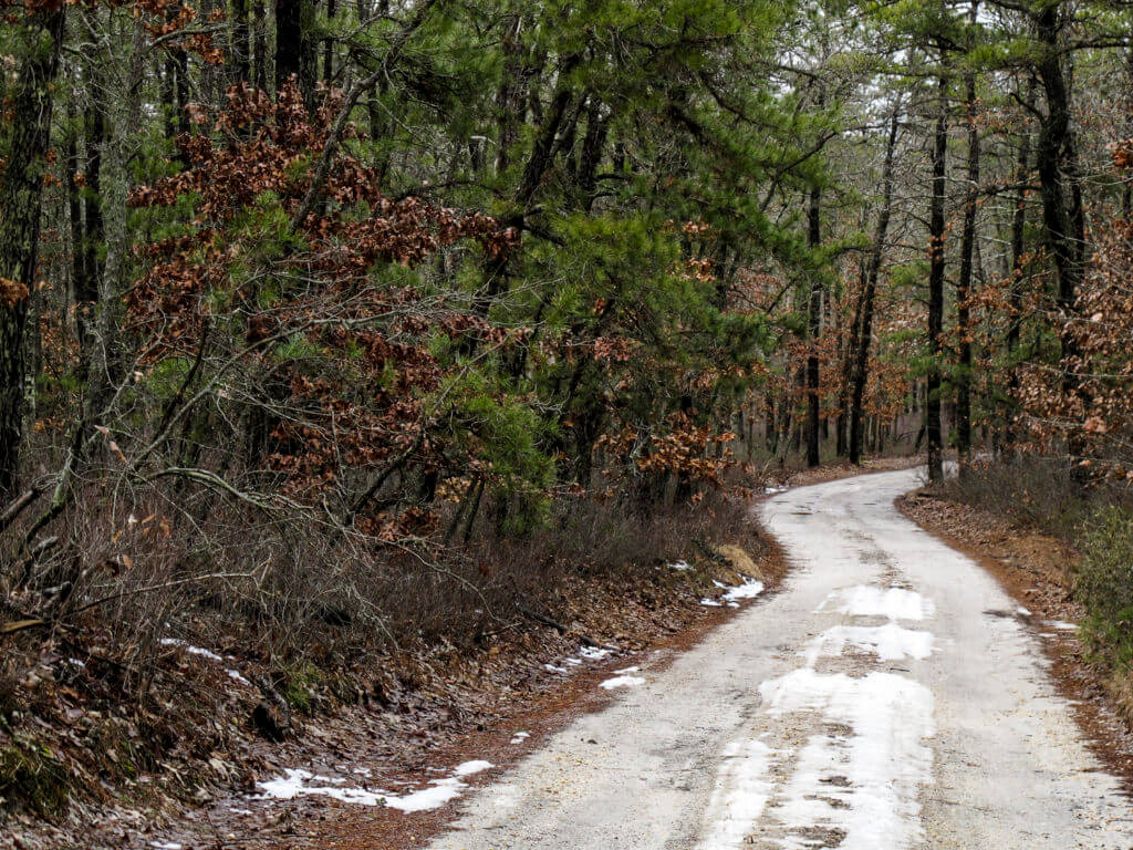
Snowy patches linger on a dirt road through the pine barrens of Wharton State Forest, in Batsto, New Jersey.
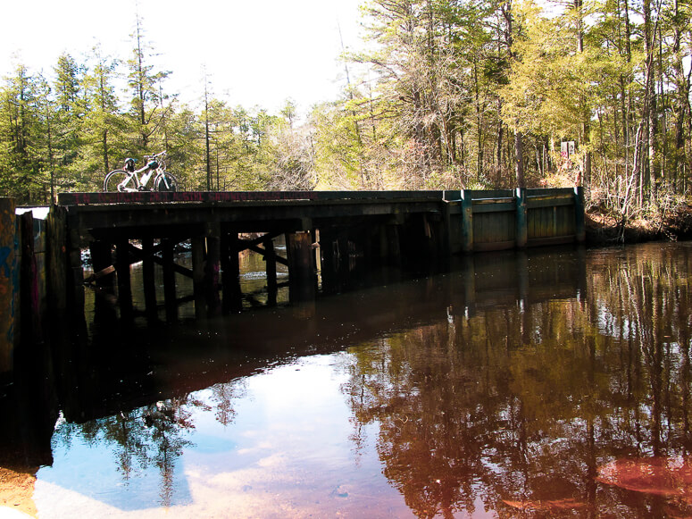
Riding in the Pine Barrens can be scenic and lovely, as it definitely is in Franklin Parker Preserve. There, the ride is varied and fascinating; you weave along cranberry bog dykes, then pine forest, then wetland and pond.
Or, the pine barrens can be challenging and slightly monotonous, as you travel the miles of wheel-grabbing, straight sandy roads through pine and oak forest. This describes Wharton State Forest.
In my experience, the Batsto area of Wharton State Forest is less appealing than Franklin Parker. The roads are straight and can be deep sugar-sand. And the forests — at least in winter — offer few glimpses of much more than the pine and the oak, for mile after mile.
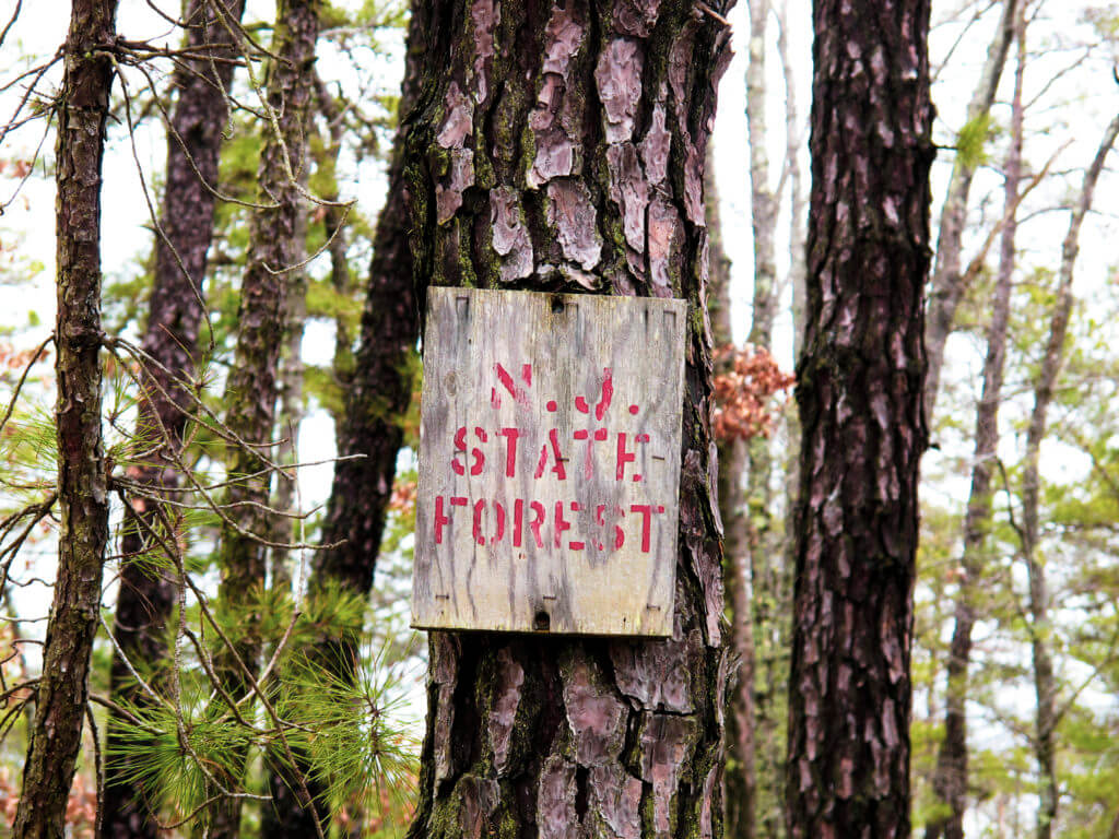
A New Jersey State Forest sign, nailed to a pine trunk in Wharton State Forest.
But I go anyway. Sometimes, just leaving the snow heaps to the north and riding, alone or with a friend, through silent, vacant forest, is enough.
More e-bike routes you might like:

Further Afield: Franklin Parker Preserve

The Minnewaska: A ‘Gunks Ride

An Empire State Trail Loop Ride: The Maybrook Trailway Past Whaley Lake
