Further Afield:
Brendan T. Byrne State Forest
Ready for an adventure? This loop ride for your e-bike puts you deep in the pinelands, along paved and unpaved woods roads, through stunning wetlands and white cedar bogs.
Length: 12 miles
Elevation change: 150 feet
Nearby Towns: Tabernacle, Chatsworth, Medford
Begin and End: At ranger station/parking area for Brendan T. Byrne State Forest on Four Mile Road
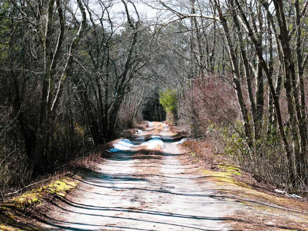
The Cranberry Trail in Brendan T. Byrne State Forest, in New Jersey. This multi-use trail was created for wheelchair hikers, so it’s easily traveled by hybrid and mountain e-bikes.
Winter drags on.
I mean: the cold. The leafless, colorless trees. The ice and snow on the roads that in summer are smooth and the roadsides shaggy with vegetation.
Desperate for a bike ride, I turn to the Pinelands National Reserve of New Jersey. Here the temperatures are a few degrees warmer than Tarrytown, just north of New York City. By car, it takes me just about two hours to get there, so I watch the weather, and I watch the snow depth maps, and just wait.
Never mind the pine barrens’ notorious associations with mafia disposal sites, Jersey Devils, or — worst of all — that suburban industrial corridor between New York and Philadelphia. This scenic natural hub is a special place, and not just because it offers a sort-of refuge from snow-covered ground within a two-hour drive of New York City.
Driving along the paved roads through the pinelands may show you one side of this rare ecosystem, but it is when you are in the heart of the pine country, in its forests — home to rare plants and animals, green winter-long, and full of history — that you appreciate its incredible diversity.
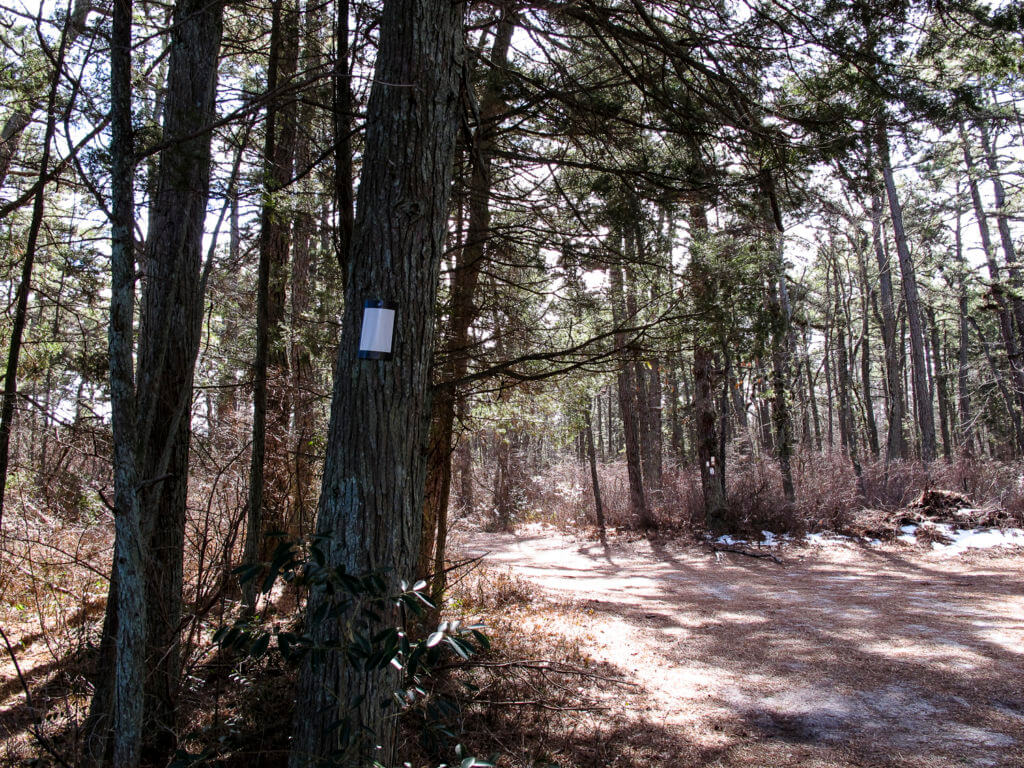
A white blaze on a cedar in Brendan T. Byrne State Forest, at the intersection of one unmarked road and another. The pinelands has its own vernacular: the coming together of many roads is called a fingerboard; a point is a place where a road forks.
The Forest
Brendan T. Byrne State Forest is in Burlington County, in the northwest part of the Pinelands Reserve. It was named for two-term New Jersey Governor Brendan Byrne, who actively fought to preserve the pines in the 1980s, and who said, “This is what I’m going to be remembered for a hundred years from now…doing something about the pinelands has been our highest-priority accomplishment.”
The vast 1-million-acre reserve was the first of its kind — a national reserve — and it saved this incredible natural gift from further industrial and suburban encroachment.
And for some reason, Brendan T. Byrne State Forest is one of New Jersey’s least-visited parks. I put that in italics because — for me, anyway — it’s hard to believe. These forests are truly “getting away from it all”, something you can really appreciate when you stop your bike for a moment, breathe in the pinelands tang and the appealing quiet.
Leave the cranberry bog roads and enter the Atlantic white cedar forests at Brendan T. Byrne State Forest. Along this 12-mile loop you’ll experience some pavement, hard-packed dirt and some loose sand.
Download the trail map for Brendan T. Byrne State Forest in south New Jersey.
The Ride
From the parking area at the ranger station, turn left onto Shinns Road, a well-paved, double-lined park road. For the next few miles, you’re heading east, the road framed by dark green pines overhead and a pleasure to ride.
Follow the RideWithGPS directions, using the map below and clicking, “Send to Device”. Soon you’ll be at the Pakim Pond picnic area with pavilions, picnic tables, rentable cabins, a restroom and a beach.
It’s worth stopping here for a snack and, if you like, a walk: lock up your bike and hike around the pond via the Batona Trail. It leaves from the left-hand side of the pond and gives you a good introduction to the Atlantic cedar bogs that are spread throughout this state forest. Note! The Batona Trail is foot-travel only. It’s a 53-mile hiking path that links several preserves in the pinelands.
Hop back on your bike, and further along, you’ll pass a campground of cabins, old and new, on the shore of the pond. (This link will give you information about camping. Scroll to the bottom.)
Following your audible directions on RideWithGPS, you’ll turn left onto Glass House Road, just before you reach the campground office. Now the road becomes narrower, an uneven macadam surface as you head into the heart of the park.
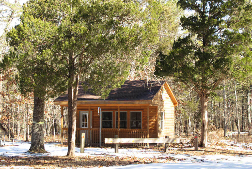
One of the newer cabins at Brendan T. Byrne State Forest, on Shinns Road. The cabins have wood stoves and bunks, with picnic tables and fire rings outside.
Into the Wilderness
Some places in the pine barrens have an undulating sameness, but this is not the case with this route. It’s full of surprises: the black streams that flow at the feet of the white cedar. The old cranberry farmlands, where the road runs between the sandy banks and dikes. The twisted oak and cedar forests.
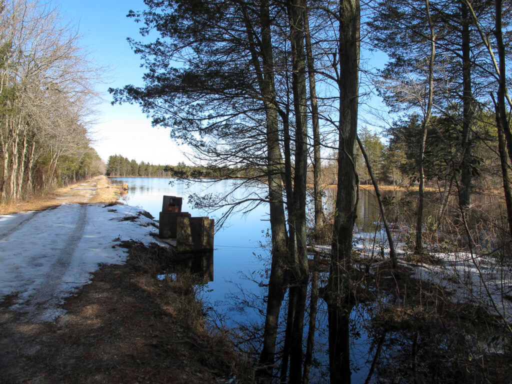
As you approach your left-hand turn off of Woodmansie Road, you may also want to continue straight ahead on Woodmansie for a short distance to take in the Macdonalds Branch. More like a wide lake than the branch of a river, this dazzling deep-blue body of water was filled with barking geese ducks and swans when I was last there. A little farther along, an unmarked drive heads off from the left and leads down to a camping area by the lake. There’s a path along the top of an earthen dam there, and from there you can watch the beavers swim and work on their massive lodge. (If you’ve taken this detour, double back to rejoin the route.)
The stretch through the cranberry bogs exposes you to wide-open blue sky and winter sun warmth. Here and there the roads can be difficult, especially after a spring thaw, when you may find spring run-off water rushing over the berms. A tip: I keep these boot covers in my backpack, and really highly recommend them. They slip on easily and allow you to walk your bike through deep puddles without getting your shoes wet.
When the route through the bogs ends, you’ll eventually reach the Cranberry Trail, a multi-use trail that narrowly threads the pines. It’s a hard-pack surface that was created with wheelchair hikers in mind, so it’s easily travelled.
Back to civilization! The Cranberry Trail ends at Four Mile Road on a shock of pavement. Turn left, and follow the road back to your car at the ranger station.
These notes are descriptive only. You should always use the RideWithGPS app and/or download the turn-by-turn directions (provided above, and by clicking “Send to Device” in the map below) for precise navigation.
The Details:
Elevation change: Barely any at all — you won’t notice.
Direction: For best results, leave your car in the parking area near the ranger station on Four Mile Road; this is the official address of the park, so if you put “Brendan T. Byrne” into Google maps, it will take you right to the lot.
From the lot, take the loop in a counter-clockwise direction, and follow the RideWithGPS audible directions on your smartphone.
The Roads:
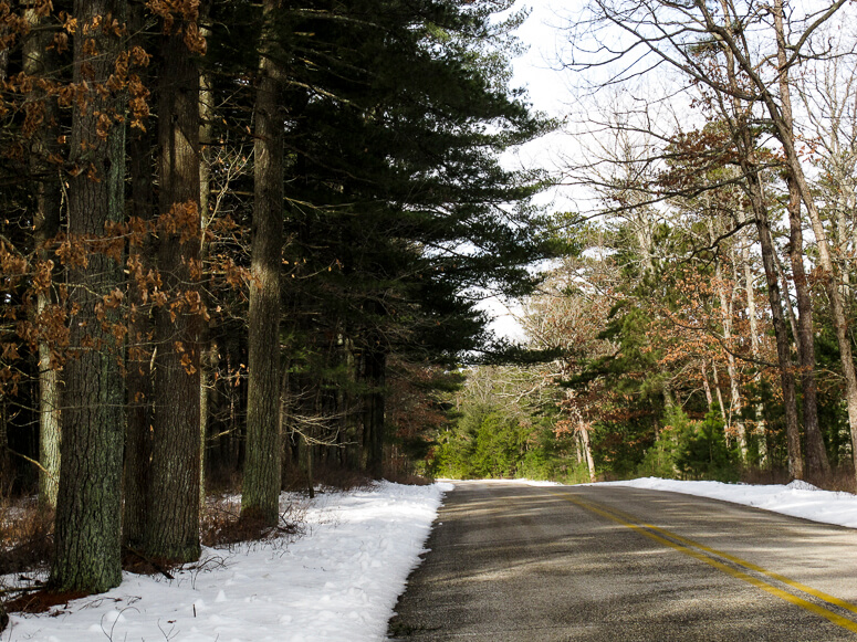
- Mostly paved, in the way that state forest roads are paved: narrow roads with no shoulders.
- Navigation in the pinelands can be tricky! Forest roads can be unmarked. Make sure you have a charged phone and a spare phone charger and a printed map.
- If you’re riding in late winter — and especially on a weekday — you probably won’t meet a single car on your ride along the entire route.
- In late winter and spring, during a thaw, water along the roads through the Atlantic cedar swamps can overflow somewhat. I prepare for this by throwing these in my backpack. They’re super lightweight, easy to take on and off once you’ve crossed the water, and they keep your shoes perfectly dry.
- Sandy roads here and there can be soft loose, “sugar” sand. About half of this route is not appropriate for skinny road bike tires. Keep your wheels straight as you ride through this stuff!
- The roads are generally wider than those found in other pinelands preserves.
- Once you leave Pakim Pond, there are no services, although cell phone reception is good. Make sure you’re prepared with spare tubes, a charged phone, food and water, and bike tools.
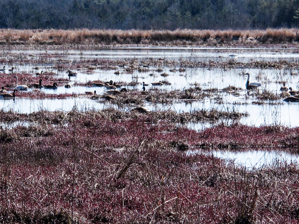
Birds gather at the swampy margins of the Macdonalds Branch in Brendan T. Byrne State Forest in the New Jersey pinelands.

Camping at Brendan T. Byrne State Forest
Cabins, tent sites and yurts constitute the camping experience at Brendan T. Byrne State Forest. The older cabins are sited at the edge of Pakim Pond; as of 2021, they are in need of updating. Newer cabins have been constructed further east along Shinns Road.
For details and to make reservations, check out New Jersey DEP’s page for Brendan T. Byrne State Forest.
The Batona Trail around Pakim Pond
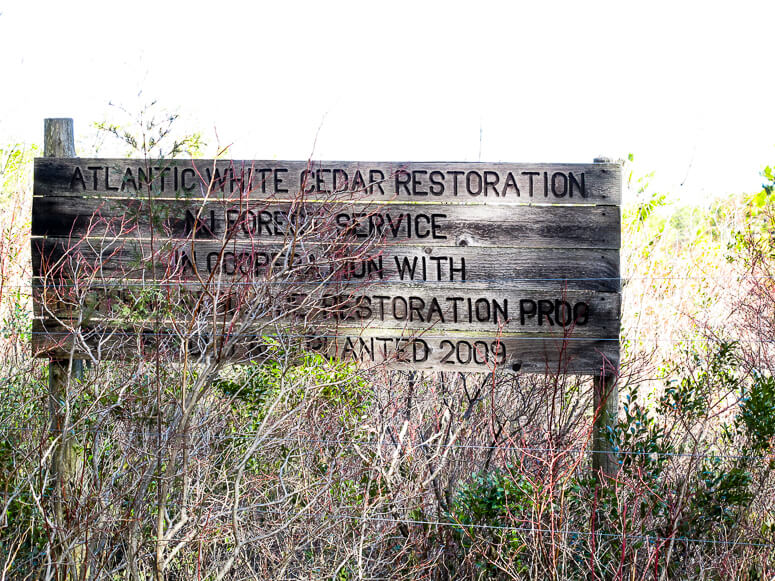
Atlantic Cedar Restoration site
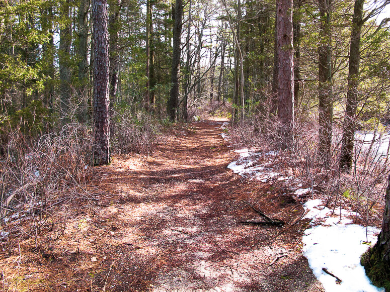
Shinns Road in late winter
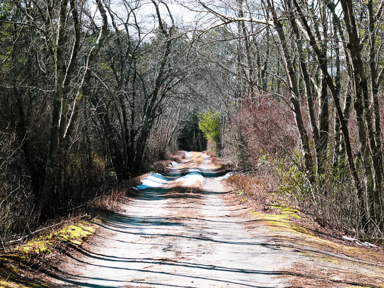
The Cranberry Trail
More e-bike routes you might like:

The Whitlock

The Vernooy Kill: A Southern Catskills Ride

The Macedonia: A Western Connecticut Ride
