New to E-Bikes? Start in Tarrytown.
ElectricBikeways is all about the ride on back-country, dirt, unlined roads. But if you’re just starting out on an e-bike, take a spin on one of the abundant, dedicated bike paths in historic Tarrytown, New York.
![]()
If you’ve just gotten into biking with a new e-bike and want to try out some of the paths that are in the lower Hudson Valley and within easy reach of the city, you could do worse than starting in little Tarrytown, New York, on the eastern bank of the Hudson River in Westchester County.
It’s a great place to start because, from the four paths that begin in Tarrytown, you can literally connect with seven (or more) bike paths — some paved, some not — from this historic rivertown. And it’s on the Metro-North Hudson Line, so when the Covid is in our rear-view mirror you can take the train from the city with your bike. (Another option: rent from Sleek Ebikes on Main Street in Tarrytown; they also have a rental station at the Tarrytown landing of the Mario Cuomo bridge.)
Here’s our list of bike paths you can ride once you get to Tarrytown:
North County Trailway
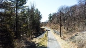
Westchester County re-paved the North County Trailway in 2020, taking out all the bone-jangling washboards and potholes and turning the trail into something you could even rollerblade.
I’d argue that the best part of the trailway is north of Millwood, New York, where the path eventually brings you to the Croton Reservoir and the historic railway bridge. But still, the path from Tarrytown is decent: wooded and cool in summer, shocking red and orange foliage color in the fall. The county has reconnected the trailway in Elmsford, so it no longer runs through the back streets of an industrial neighborhood, but follows a stream through the woods. And at last they’ve repaired the shoulder along Route 100.
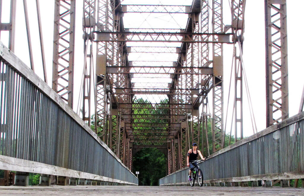
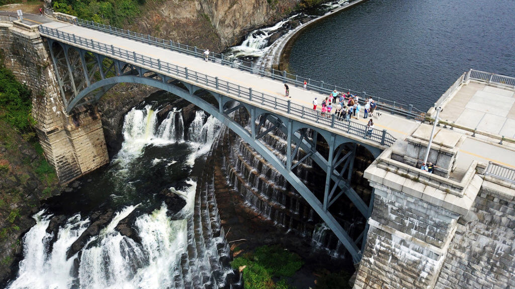
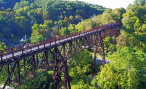
The old railroad bridge over the Croton Reservoir. The bridge crossing is part of the North County Trailway, which begins in Tarrytown, New York.
If you’re up for the whole ride north, it’s a 22.1-mile trip. You can do it as an out-and-back, or even continue for 11.9 miles on the Putnam Trailway to the Brewster train station, taking the Harlem Line from Brewster back to the city.
A nice, shorter ride can be made by biking from Tarrytown to Briarcliff along the Trailway, and taking the little “exit” off the bike path just before the Briarcliff Library. From there, cross through Law Memorial Park and turn right onto Pleasantville Road, taking it into town. Just past the town hall and police station, you’ll find the Moonbeam Cafe; it has a nice porch for enjoying your coffee. There’s also The Patio, right next door to Moonbeam, with classic diner options and a sunny patio under umbrellas.
As a bonus, you can charge your bike outside the Briarcliff Library. There’s a bike stand with a power outlet adjacent.
To get to the North County Trailway: Begin at the parking area for Tarrytown Lakes, at the corner of Neperan Road and Irving Ave in Tarrytown. Take the paved spur trail that begins just across the street from the parking area. In one mile, you’ll arrive at the old pump house on the left. Cross the street here, and turn right onto the sidewalk. In just one-tenth of a mile, turn left onto the entry ramp for the Trailway. At the end of this ramp, you’ll meet the trailway. The North County Trailway goes to the LEFT.
South County Trailway
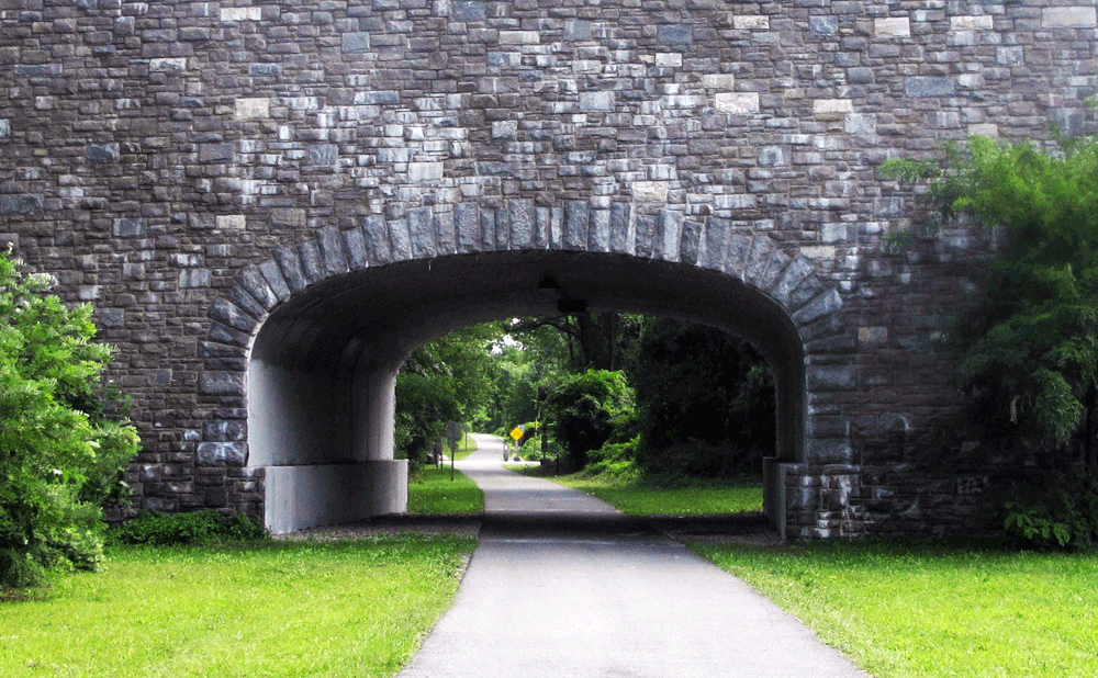
You’d miss the stonework of the Saw Mill River Parkway unless you saw it from underneath, along the South County Trailway.
It’s the end of 2020 as I write this, and Westchester County is in the process of re-paving the South County Trailway. This is good news for local cyclists, because that trailway has been a rough ride for a long time. If they do as good a job with the South and they did with the North County Trailway, the whole system will be a real treat.
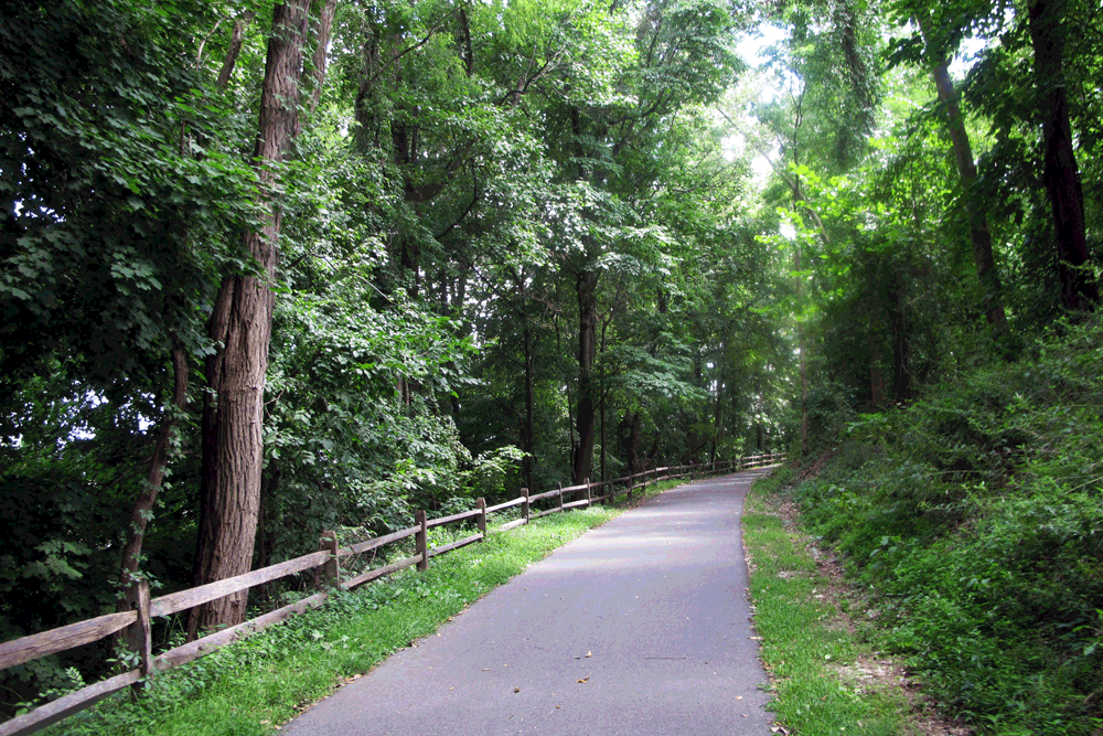
The South County Trailway, though it traverses some heavily-populated areas of Westchester, is surprisingly wooded and peaceful. Even when it runs alongside the Saw Mill River Parkway, a dense margin of trees keeps the sound down to a dull roar.
I love the old stone bridge arches along the South County, and the diversion through Great Hunger park, with its pond and ‘waterfall” — the spillway of a dam of the Saw Mill River. Stop at La Lanterna, a beer and wine garden, for a pizza and brew, if you’re hungry — it’s right on the pathway.
And you can combine the South County Trailway with New York City’s plentiful greenways and make an exhausting day of it. In fact, it’s possible to ride from Tarrytown to Pelham Bay Park entirely on bike path, by connecting with the Mosholu Greenway in the city, just after the Van Cortlandt Park golf course.
To get to the South County Trailway: Begin at the parking area for Tarrytown Lakes, at the corner of Neperan Road and Irving Ave in Tarrytown. Take the paved spur trail that begins just across the street from the parking area. In one mile, you’ll arrive at the old pump house on the left. Cross the street here, and turn right onto the sidewalk. In just one-tenth of a mile, turn left onto the entry ramp for the Trailway. At the end of this ramp, you’ll meet the trailway. The South County Trailway goes to the RIGHT.
Old Croton Aqueduct
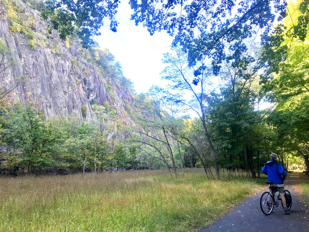
Oh, if only we could bike those wonderful, wide, wooded carriage roads through Rockefeller State Park Preserve. But until that day comes, there’s the Old Croton Aqueduct Trail. Stretching from the new Croton Dam in Ossining down to the trail’s end in Yonkers, the aqueduct is just a fascinating trail. It’s also wooded and unpaved, and keeps a pretty consistent elevation along its 26.5-mile run.
It gets pretty bumpy, though, what with all the tree roots and curb cuts to cross. you will need a hybrid bike at least. And during the spring thaw, parts of the trail are nearly impassable without fat tires, due to mud and remaining slush and snow.
But in the summer, it’s a pure pleasure. The pathway takes you on a route you can’t simply stumble on from a car or road. The feeling, as you pedal through a backyard on this little dirt track, is like pedaling home from school on the well-worn short-cut.
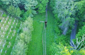
Some of the best stretches of the trail start in Tarrytown, just south of the Mario Cuomo (nee Tappan Zee) Bridge, in Lyndhurst Mansion. Rolling through that wide lawn, crossing the campus at Mercy College and Nevis Labs, passing by the Armour-Stiner Octagon house, an architectural confection in pink (definitely pull over to look at this one!), there is always something new to discover. The trail bisects most of the colorful “rivertowns”, If you bring a bike lock, you can enter the Untermyer Park and Gardens, an immaculate and mysterious public park in Yonkers and one of the most celebrated Persian walled gardens in America.
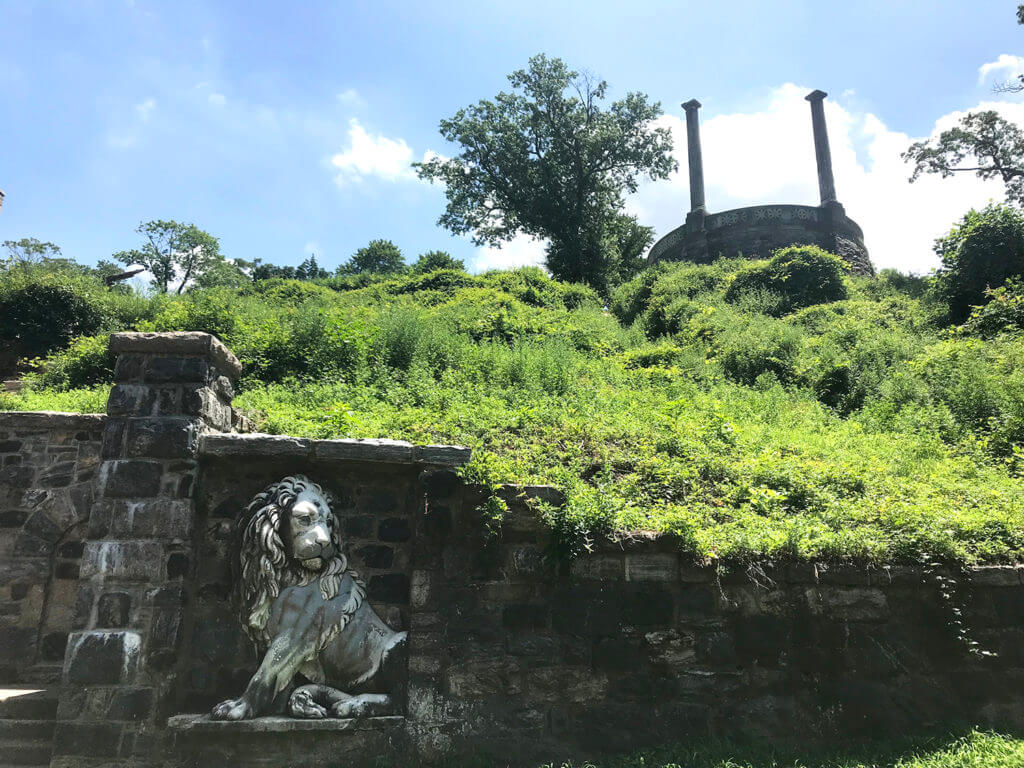
The back entrance to Untermyer Park and Gardens, on the Old Croton Aqueduct Trail.
The OCA also extends north from Tarrytown, running through neighborhoods, backyards and cemeteries to eventually reach the New Croton Dam. Though it gets a little tricky to navigate — especially in Tarrytown, and because Google Maps doesn’t show the complete, connected route — you can use this RideWithGPS route, here:
The section north of Tarrytown is more rural in nature, as the trail narrows down to a single track in places, and dips out briefly onto busy Route 9, which can be hair-raising at rush hour. And there is one god-awful, rutted climb out of a trench in Ossining that will have you pushing your bike up a hillside and wondering if you’ll make it to the top.
But the rewards of this trail, especially in warm summer months when the backyard flowers are in bloom and the grass is tall, far outweigh the challenges. It will take you a few hours to get from Tarrytown to either of two ends, so plan your day accordingly and leave yourself plenty of daylight.
To get to the Old Croton Aqueduct Trail: If you’re coming by train, leave the train station and head up the hill in Tarrytown via Main Street and the business district. At the corner of Main Street and Broadway, cross Broadway and continue briefly up Neperan Road. Keep a sharp eye out for the trail entrance; you’ll come to the trail just past the Archer Street. To your left, the trail goes north. To your right, it goes south.
There’s also a parking lot at the corner of McKeel and Broadway. You’ll find the trail just uphill from that lot.
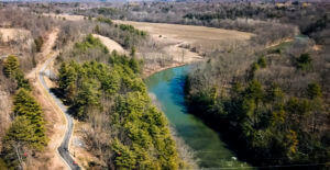
The New Croton Dam, the northern terminus of the Old Croton Aqueduct Trail.
Riverwalk
The Riverwalk in Tarrytown is a mere stroll, both in length and purpose. It’s a brief completed segment of the 55-mile planned route that will one day extend from Yonkers to Peeksill along the Hudson. I’m including it here because 1) however short, it’s pretty, 2) it leads to the Sleepy Hollow lighthouse, Kingsland Point Park and the eye-catching mural along the lighthouse promenade and 3) it’s just a great little hang-out, especially on a summer evening. People fishing from the rocks, kids riding teeny bikes in a crooked line, old folks enjoying a cone from Lighthouse Ice Cream & Coffee. And I highly recommend the riverside dock at Barley on the Hudson, a hidden respite for locals in Tarrytown. Hard to spot, but you’ll find it in the parking lot on the west side of the train station.
To get to the Riverwalk: Pick up the Riverwalk anywhere on the west side of the train station, in Pierson Park. It goes south to Losee Park, and north to just beyond the Philipse Manor train station.
Mario M Cuomo Shared-Use Pathway
Newly-opened in 2020, the shared-use path over the Hudson River, via the Mario M. Cuomo bridge, is a brilliant connection between the two shores of the river. Six rest stops, or “belvederes” offer a place take in the expansive view of the distant Hudson Highlands, the sister villages of Nyack and Tarrytown, the little white lighthouse, and whatever else is going on in the waters below.
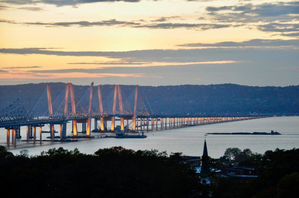
Tarrytown, along the Hudson River, with the shared-use path across the bridge.
But the pathway is also a long-anticipated connection between the extensive trail network of Westchester County to the east, and the paths to Piermont and Haverstraw to the west. In fact, it is nearly possible to leave Battery Park in Manhattan by ferry to New Jersey and Liberty State Park, bike up the west side of the Hudson River to the bridge, cross the bridge, and with a combination of bike path and Metro-North train connection, continue all the way up to Millerton, New York, at the New York-Massachusetts border — almost entirely on dedicated bike path. I call this the Immigrant Route, because it takes in so much of the historic civil work done by immigrants to this country in the early part of the last century: the massive stone dams, the roads and trails, the aqueducts.
To get to the Mario M. Cuomo Shared-Use Pathway: The Tarrytown landing for the pathway is located on Broadway, just north of the bridge’s on-ramp. There’s a parking lot there (free), and public restrooms.
Two Trails on the West Side of the Hudson: The Esposito Trail, and the Nyack Beach State Park Trail
Once you’ve crossed the Mario M. Cuomo bridge from Tarrytown, the path splits off and you can choose to ride either north or south.
To the south, you can join the unpaved, wooded Esposito Trail; to the north, you’ll ride through Nyack to get to the Nyack Beach State Park trail, running alongside the Hudson River. Both are scenic, level and fairly easy to ride.
Esposito Trail
The Esposito Trail runs from the heart of Nyack to Piermont, following an old railroad bed of the former Northern Railroad line. It’s 2.5 miles of unpaved and largely unmaintained trail, but regular use by locals keeps the overgrowth at bay. From the bridge to Piermont, it ranges in width from single-track to wide hardpack.
From the landing at the bridge, turn left; follow the trail for 2.5 miles until you reach the old Piermont train station building, now operating as a small museum of local history. (You can continue for another two miles, into Sparkill; if you do, I recommend the baked goods and coffee at Noble Cafe, on Union Street.). From the train station building, drop down into Piermont via Hudson Terrace and Ash Street. In town, you’ll find a wide range of eating options, great pizza, a spectacular 1-mile ride out onto the Piermont pier, jutting into the Hudson. You can also take your bike onto the dirt roads of Tallman State Park, just south of Piermont.
To return to Tarrytown from Piermont, I suggest riding along River Road. Point your wheels toward the bridge but don’t climb the hill back up to the trail. River Road follows the shoreline; the scenery here is the pretty homes perched along the water. When you get close to the bridge, follow the signs back to the pathway.
Nyack Beach State Park Trail
I love this path. Skirting the edge of the Hudson at first, it slowly eases away and into the woods of Hook Mountain, traveling along the steep escarpments of the Palisades that rise up from grassy floors. The path is easy to ride and relatively flat to start, but becomes a bit more of a roller coaster as you approach Haverstraw.
This is a 5-mile, out-and-back trail — at least until the ferry from Haverstraw to Ossining begins its route again when Covid-19 is under control. (At that point, you’ll have the option to complete a wonderful loop from Tarrytown to Haverstraw, returning via ferry and train to Tarrytown).
Below Hook Mountain, on the Nyack Beach State Park trail.
Note: If you’d like a little more trail than the 5 mile trail offers, you can detour onto the bike path around Rockland Lake. To do this, take the spur trail at 1.7 miles in, and follow it up the (quite steep) Landing Road to Rockland Lake Road, and take a spin around the lake on the paved path. The loop will add about 3 miles to your ride.
To get to the Nyack Beach State Park Trail: Once off the shared-use pathway over the bridge, continue into Nyack, and at the end of the paved pathway, turn right onto Clinton, then left onto Broadway. You’ll travel through the business district of Nyack, where car drivers seem at least a bit bike-savvy and will give you space. Keep going for 2.5 miles along North Broadway, as the businesses peter out and you pass elegant riverside estates. At the very end of North Broadway, enter Nyack Beach State Park, and follow the road down to the river’s edge parking area. At the far end of the parking area, the pathway starts.
These notes are descriptive only. You should always use the RideWithGPS app and/or download the turn-by-turn directions (provided above) for precise navigation.
More Stories from the Empire State Trail:


More e-bike routes you might like:

An Empire State Trail Loop Ride: The Maybrook Trailway Past Whaley Lake

The Omega

The Steep Rock
