Further Afield:
Stokes State Forest, and the Tillman Ravine
The off-season is the perfect time for this electric bike adventure in Stokes State Forest. In winter, the gated roads are off-limits to cars, but not to your bike. This is when the sense of isolation is deepest, and the hillsides, thick with hemlocks, provide a welcome contrast to the blahs of winter.
![]()
Length: 12 miles
Elevation change: 997 feet
Nearby Towns: Milford, Lafayette, Blairstown
Begin and End: At the Tillman Ravine Parking Area
Spring, summer and fall, the forests of the Tillman Ravine and Buttermilk Falls area of Stokes State Forest and the Delaware Water Gap are accessible by car, drawing hordes to the trails and waterfalls. But come December, the roads that wind through the evergreen forest are gated and quiet; they become as much a dedicated bike trail as those rails-to-trails are.
The off-season is the perfect time for an electric bike adventure here. This is when the sense of isolation is deepest, and the hillsides, thick with hemlocks, provide a welcome contrast to the blahs of winter. And when, at last, the Walpack Inn reopens, warm brown bread and a hot bowl of soup is your reward at a little more than halfway around this ride.
Begin at Tillman Ravine
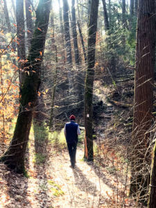
Leave your electric bike locked in the parking area for Tillman Ravine and hike the paths through majestic old-growth hemlock forest.
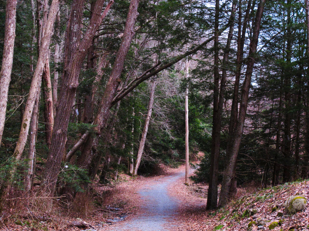
This lollipop-shaped route begins in a parking area on Dimon Road, directly across from the entrance to the 4-H camp. In the winter months, you’ll find the road down to the Tillman Ravine blocked by a gate. Swing your bike around the gate and continue — mostly downhill — along a well-paved road towards the ravine.
Mountain Road, in the Delaware Water Gap National Recreation Area.
As you ride, the woods become greener with pine and hemlock, and thick pillows of moss. In two miles, arrive at the first parking area for the Tillman Ravine. It’s worth checking out the foot trail here, so lock your e-bike and follow the wending path through a spectacular stand of old growth forest and alongside a frisky stream (and if you decide to do this hike, the whole loop should take no more than 45 minutes or so).
The road continues, in some places sharply downhill here, until you arrive at a four-way intersection. The Walpack Cemetery dates from the 1800s and has several interesting headstones, grim reminders of how difficult it was for children to survive their first ten years at the turn of the century. You’ll turn left here, onto Mountain Road, a hardpack, unpaved road.
To Buttermilk Falls
A sense of remoteness envelopes the road now. To the right a wide shaggy field leads to a riparian bottomland, with distant mountain views. On your left, the forest rises sharply uphill, as the road in front of you maintains a level progress through a deepening hemlock stand.
Soon you’ll hear the sound of tumbling water: Buttermilk Falls, the tallest waterfall in New Jersey at nearly 100 feet. And lucky you: riding this road in winter, with the gates closed at either end, usually means you will have the falls all to yourself. Where the falls and the parking area are packed to the gills in summer, now you find yourself alone under the tallest waterfall in New Jersey. A set of steps scamper up the side the falls and lead to an observation platform at the top. (Use caution when climbing these stairs in the winter, when ice may be present!)
And as pretty as these falls are, the highlight of the ride is in the hemlock forest itself. The road continues through a dramatic glacier-carved ravine of dense old-growth hemlock, one of the few remaining stands of such forest in all of New Jersey. The forested hillsides, thick with evergreen and tulip poplar, are a colorful, welcome relief: instead of the monochrome, ashy gray of a bare deciduous forest, rhododendron and ferns blanket the ground under these majestic trees.
The end of Mountain Road begins to get rockier as you approach its southern end, passing an old tumble-down barn to the right. Cross the single-lane iron bridge over Big Flat Brook, and turn left. (The road to the right is now so overgrown and covered in blow-downs as to be untravel-able.)
Into Walpack Center
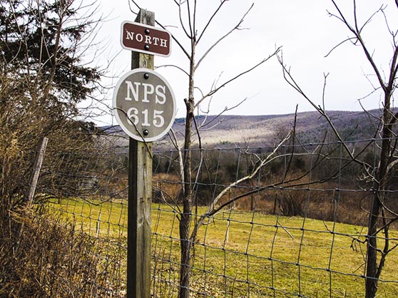
Old highways signs by the National Park Service are mounted on cedar posts. The road to the Walpack Inn is double-lined, but mostly abandoned in winter.
National Park Service Road 615 will feel deserted in winter. It’s a rural road that passes by abandoned-looking farmhouses and a campground of semi-permanent trailers. I doubt you will pass a car along the entire cedar-lined length of this section. And that’s a good thing: there isn’t much of a shoulder along this double-yellow-lined road. But the road is sweet and well-paved, with lots of open-sky exposure to warm you on sunny winter days.
And then, as in a mirage (because this really fits the definition of “middle of nowhere”), you come to the Walpack Inn, a classic country restaurant set against a Delaware Water Gap hillside. I’ve loved this place from the first time I found it on a Sunday drive and sat in the greenhouse dining room, savoring their warm brown bread, a bowl of soup and friendly service. And more recently, when COVID forced their dining room outside, to the backyard, overlooking serene hillsides of the Delaware Water Gap. The Inn is closed now, but will (I hope!) reopen when the pandemic has subsided somewhat. When it does, don’t resist a stop here for lunch or a beverage before continuing.
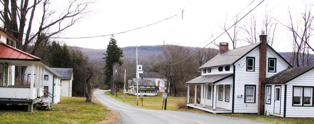
Main Street, through Walpack Center.
Past the Walpack Inn, you’ll turn right onto Main Street. You immediately come to Walpack Center, a preserved 1800s-era ghost town with whitewashed small-town basics: a post office, a well-built church, a one-room schoolhouse, and assorted homes and barns, now empty. Like so many small rural settlements in the Delaware Water Gap, the town was purchased by the Army Corps of Engineers in the 1960s, to prepare for a dam that would create a 37-mile-long lake between Pennsylvania and New Jersey. The project, called the Tocks Island Dam, was never built. Today the town is owned by the National Park Service, and is home to less than two dozen inhabitants. Stop here to stand on swayback wooden porches and peer through silted windowpanes into the past.
The Return Through the Ravine
Continuing, you’ll cross a second one-lane bridge over Big Flat Brook, and soon you’re back at the north side of the cemetery. Continue straight, retracing your route through the Tillman Ravine and back to your car.
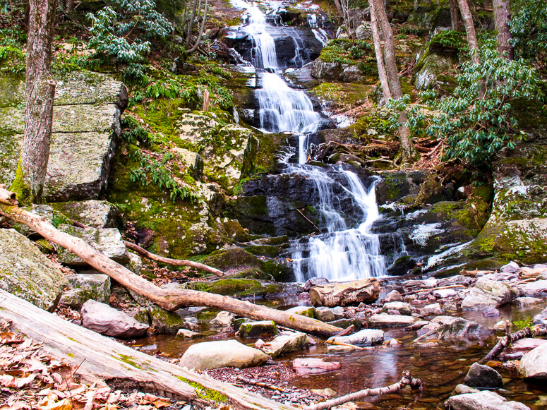
Buttermilk Falls, at 100 feet, is one of the tallest waterfalls in New Jersey. Ride your ebike along quiet roads closed to cars to get to this pretty waypoint.
The Roads:
- An easy ride. The road through the Tillman Ravine area is well-paved and shows little wear. Mountain Road is unpaved, but fairly smooth until about 1/4 mile before the southern end, when it gradually becomes more stoney. All other roads on this ride are paved.
- Except for the Walpack Inn, there are no businesses along this route. There are primitive toilet facilities in the parking area at Tillman Ravine, but when we were last there, the “mens” was closed.
- NPS Route 615 is a double-yellow lined road and has no shoulder, but I have rarely seen a car on it. This might change when the Walpack Inn re-opens, so I will update.
Afterwards:
As mentioned, the Walpack Inn is a special place to break up your ride or have an after-ride lunch or drink.
Milford, Pennsylvania is a little less than 15 miles north of the Tillman Ravine. It’s a charming, historic town with several restaurant choices, ranging from fast-casual and coffee houses (try Milford’s Daily Grind, on 7th Street) to fine dining at The Delmonico Room at the Hotel Fauchere. But we’ve always found our way back to the Waterwheel Cafe, on Mill Street. It’s a low-ceilinged, timber structure — a former mill — with excellent food and bakery items as well as beer, wine and cocktails. It’s open for breakfast, lunch and dinner (closed on Mondays).
The winding NPS highway 615 continues on south of the Walpack Inn and offers a gorgeous, remote drive along the riparian bottomlands of the Delaware River. If you’re looking for the long way home via the scenic route, this is a good option.
And of course you’re in the Delaware Water Gap National Recreation Area. If you’ve planned ahead, take advantage of the camping sites along the Delaware River, or spend an extra day riding the McDade Recreation Trail, a 31-mile long, mostly-flat bike trail that runs from East Stroudsburg to Milford Beach.

Camping at Stokes State Forest
Stokes State Forest has five camping areas, with a variety of camping experiences. Cabins, enclosed lean-tos, group sites and primitive (pit toilet only) sites constitute the offerings within the forest. All camp areas have potable water.
For details and to make reservations, check out the NJ Outdoors page for Stokes State Forest.
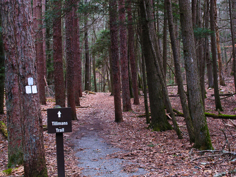
Tillman's Trail leads to a waterfall and pretty path alongside Tillman Brook.
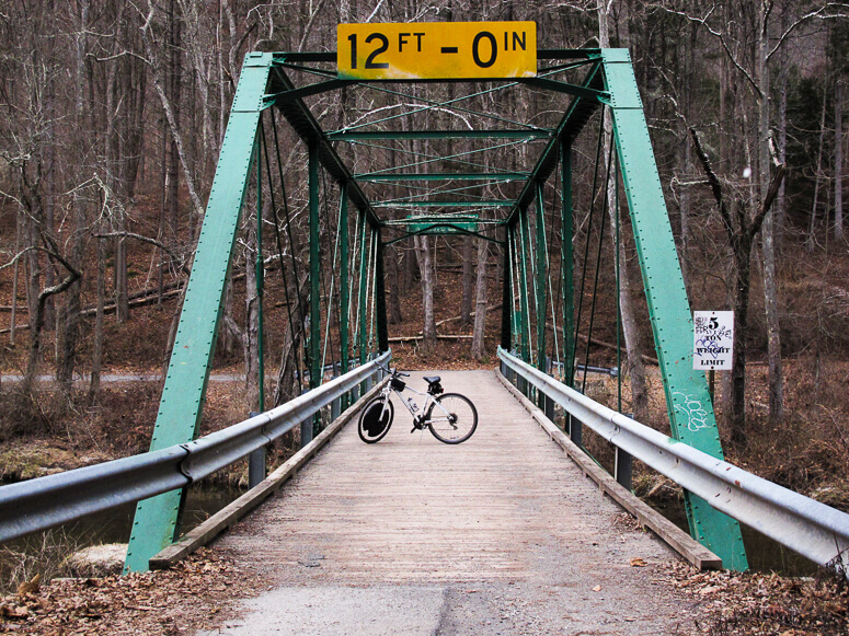
A one-lane iron bridge crosses Big Flat Brook at the end of Mountain Road.

Walpack Cemetery
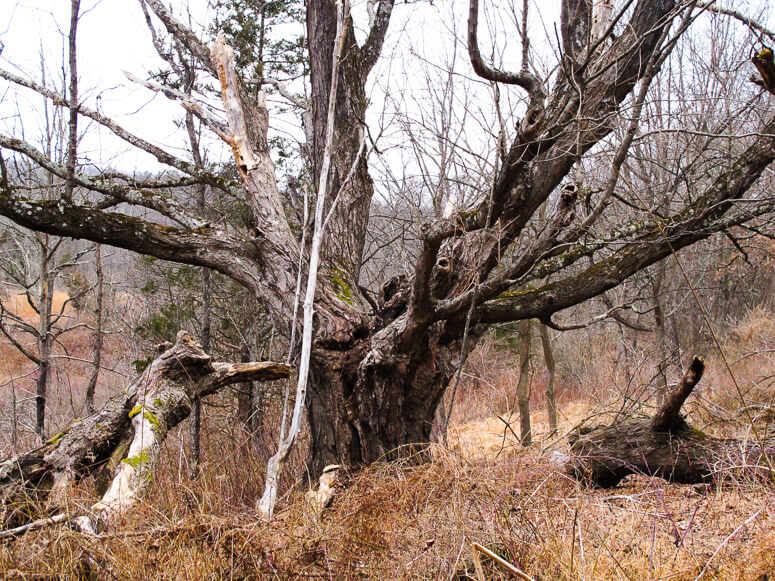
A massive sugar maple along Mountain Road.
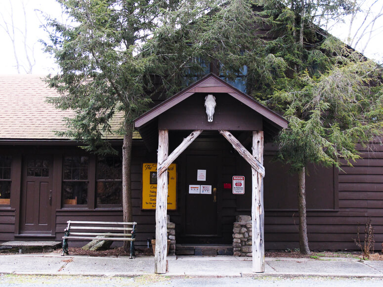
The Walpack Inn.
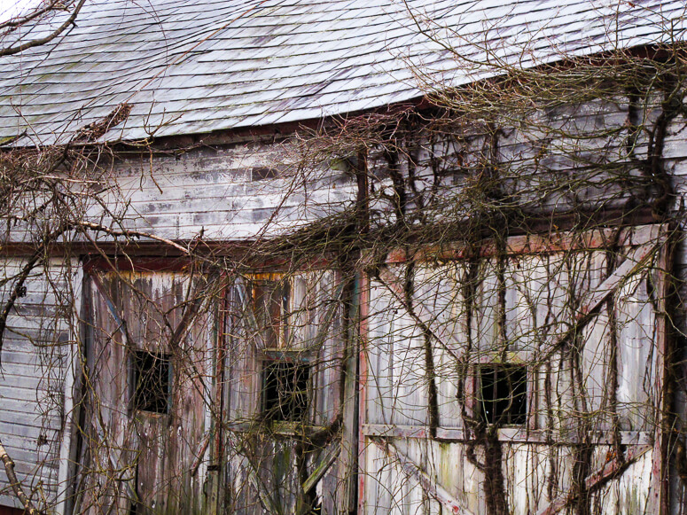
Vine-covered, abandoned barns are iconic reminders of the Gap's past.

Mossy Log, Tillman Ravine
More e-bike routes you might like:

An Empire State Trail Loop Ride: The Maybrook Trailway Past Whaley Lake

The Whitlock

The Sherman
