The Garrison:
A 17-mile tour through the historic Hudson Highlands
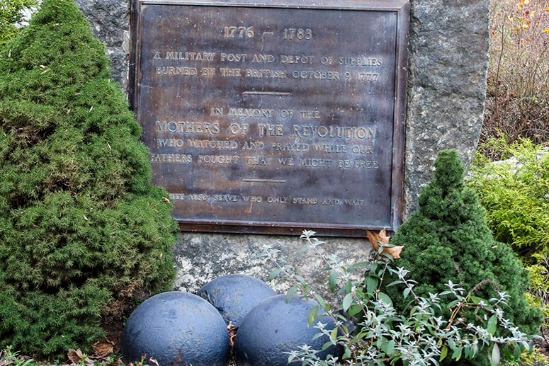
Watch carefully for signs of the Revolutionary War — canon balls, milestones and markers — along this lovely wooded route in Putnam County.
![]()
Length: 17.1 miles
Elevation change: 1,632 feet
Nearby Towns: Garrison, Cold Spring
Begin and End: At the parking area for the North Redoubt Trail on Snake Hill Road, Garrison.
Climbing the narrow hillside in Garrison, it’s easy to think the Old Albany Post Road hasn’t changed much since the mid-1600s. Still rugged, still unpaved, you can’t help thinking of the soldiers of the Revolution, who walked the distance from Garrison to Continental Village along this route, probably having to stop and catch their breath at the top of the rise. Like I did.
You’ll ride the Old Albany Post Road for most of its length on this 17-mile route. Keep a sharp eye out for old milestones. They still stand along the side of the road, and have been protected in recent years by the Preservation League of New York State.
The Ride
This loop is a intimate, hilly ride on the dirt roads of the Hudson Highlands. You can park at the North Redoubt Trailhead parking area on Snake Hill Road, just outside Garrison. Turn left out of the parking lot, and you’ll immediately turn into a quiet neighborhood on Avery Road, lined on both sides with majestic sugar maples.
It’s a little rural-suburban at first (watch for those impressive garden sculptures!). But gradually the driveways thin out; the road becomes hardpack as it winds and you climb through a hemlock, pine and spruce woods and ravine.
A few miles into the ride, you’ll find yourself engulfed in forest, an occasional odd dwelling or grander home here and there.
After you cross Route 9 (be careful!), the more rugged part of your ride begins. Put on your climbing legs: you’ll soon be joining the Old Albany Post Road, grinding uphill for a significant stretch. Catch your breath at the top, near a milestone on the right.
This historic byway, long made redundant by its “sister” Route 9, is one of the oldest unpaved roads in the United States. Originally a postal route, it followed the narrow, ancient trails of the Wiccoppe and Wappinger tribes. Later, it served as a major artery for troop movement in the Revolutionary War.
The back roads of Garrison are mostly dirt and hardpack. So it’s surprising that a number of homes — modern and historic — line these roads. The Old Albany Post Road is no exception. In winter, when the trees are bare, you can see every one of these constructions from the road. So I recommend a summer ride, when the trees create a narrow green tunnel to shade you, stone walls at their feet.
You’ll follow the Post Road along the top of the hill, and then descend to your turn at Highland Road, at a lovely corner of barns and stables.
The road from here is typical Hudson Valley: farm and field, alternating with hardwood forest and hemlock ravine. In the folds of the Garrison backcountry, wide views don’t open up around every corner. Instead, it’s a more intimate ride, with historic homes sitting behind high hedges, beautifully refined stone walls where the mossy arms of old apple trees stretch over. A fish and game club appears at the edge of a heartbreakingly beautiful pond. A creek appears alongside the road, then disappears into the valley.
After a series of turns, Horton Hollow road becomes Sprout Brook Road. It’s double-lined all the way, and the shoulder is barely there as you descends into a bland neighborhood of newish homes.
To avoid the 3-mile ride on Sprout Brook Road, you can take this shortcut: turn right onto Canopus Hill Road (before you get to Horton Hill), and follow it ever upward as it grinds around the hillside. Catch your breath at the top, and keep an eye out for a historic marker designating the location of the Hempstead Huts, on the right. A state historic sign here describes the Revolutionary War field hospital that operated at the site. Rejoin the route at the end of Canopus Hill Road, where it meets up with the Old Albany Post Road, and turn right.
At last you rejoin Snake Hill Road, leaving the hardpack road behind. This can be a somewhat busy road during the day on weekends, so stick to the shoulder. It’s an easy downhill, paved pedal back to the North Redoubt Trail parking area.
These notes are descriptive only. Follow along on the RideWithGPS app and/or download the turn-by-turn directions (provided above) for precise navigation.
The Details:
Elevation change: 1632 feet up and down over the whole ride.
Direction: For best results, take the route in a clockwise direction: leave your car at the parking area for the North Redoubt Trail, then turn left out of the parking area, then right onto Avery Road.
The Roads:
Most roads on this route are unpaved, though you’ll also find long stretches of pavement. Do go slowly on the unpaved roads, though: washboard surfaces can come up on you fast!
Use caution crossing Route 9 where it intersects Indian Brook Road. The traffic is heedless and zippy.
While I try my best to stay on unlined coutnry backroads, sometimes the busier roads are unavoidable. For the Garrison, I had to pick up the somewhat busier Sprout Brook Road, and for this reason, this route is NOT recommended for kids.
Train Access:
It’s a little over a mile to get from the Metro-North station in Garrison Landing to the start of the route on Avery Road. Ride uphill from the station to Upper Station Road, then turn left onto Route 9D. Once you pass the Garrison Pizza Cafe, watch for Snake Hill Road on the right. Turn right onto Snake Hill Road and you’ll reach the North Redoubt Trailhead parking area in .2 mile.
Afterwards:
Dolly’s, located in sleepy Garrison Landing, is not a bad place to find yourself once your ride is over. Indoors or outdoors, the view across the Hudson River to West Point is unrivaled. And occasionally, the Metro-North train from the city pulls up and unloads a mob of blue-clad cadets who then board the ferry across the river to West Point. Enjoy a can of Czech beer to go with the views of towering West Point.
You’re not far from the shop-lined streets of Cold Spring, directly across the Hudson from Storm King’s glowering face. Caffeine and brew are easily found. Here, you can take it easy on the porch of Hudson Hill’s Cafe, a sunny spot with a creative, locally-sourced food menu. Or if you like the sound of creaking boards under your feet or a the smell of a crackling fire in the colder months, pull up a chair at the Cold Spring Depot, the used-to-be train station at the bottom of the hill. Paper placemats, with a design unchanged for decades, tell the story of the depot’s colorful past.
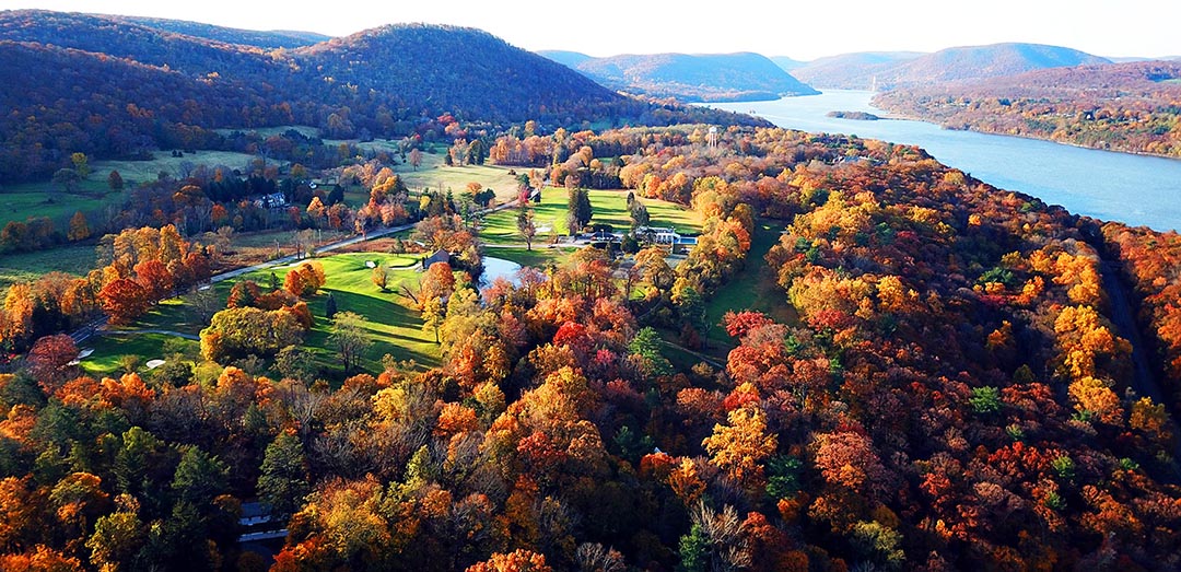
An aerial view of Garrison, New York, on the eastern side of the Hudson River and Highlands.

A collector's barn in Philipstown
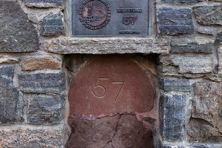
Mile marker along the Albany Post Road

Private roadside sculpture garden
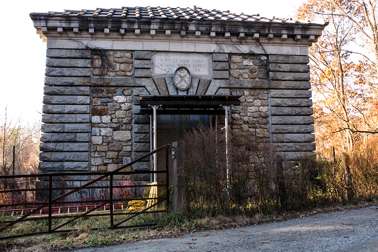
Catskill Water Supply aqueduct siphon chamber on Avery Road
Entry to Continental Village at the end of the Albany Post Road
More e-bike routes you might like:

The Steep Rock

The Garrison

The Perkins Memorial

Further Afield: Stokes State Forest and Tillman Ravine
More e-bike routes you might like:

The Ashokan: A Catskills Ride
The Garrison
